Research Topics

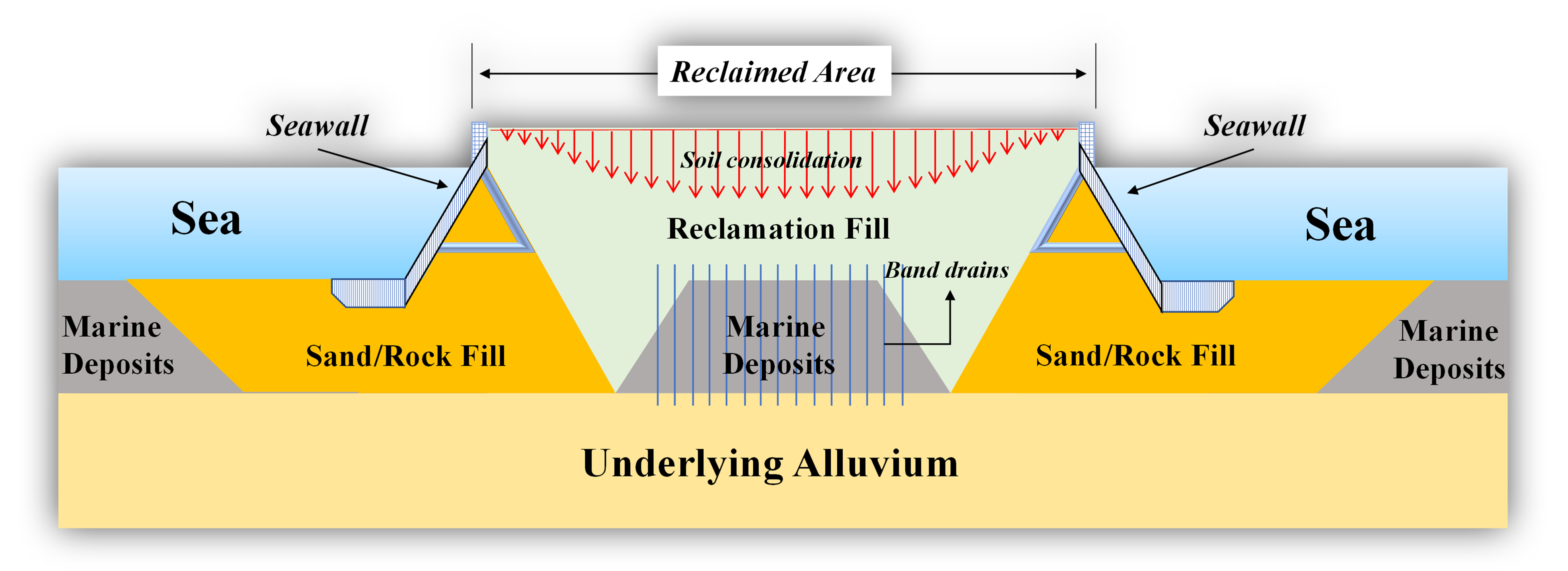

PI: 4D Mapping of Rapid Consolidation of Marine Reclamations Using MTInSAR and Deep Learning, Hong Kong Research Grants Council ECS.
PI: Monitoring and predicting slope instability in forested terrain from multi-mode remote sensing data, Hong Kong Research Grants Council GRF.
PI: 結合多時相InSAR與固結理論的填海區非線性形變監測與模擬, NSFC.
PI: Remote sensing geological vulnerabilities for Hong Kong’s new reclamations, UGC-PolyU.
PI: Enhancing Coastal Reclamation Modelling Using Satellite Geodesy and Deep Learning, UGC-PolyU.
LSGI 3382A Survey Instrumentation (1st semester)
LSGI 3781 Engineering Surveying (2nd semester)
LSGI 548 Advanced Survey (2nd semester)
LSGI 4104 Geomatics Project Management (1st semester)